The Geography of Sarawak
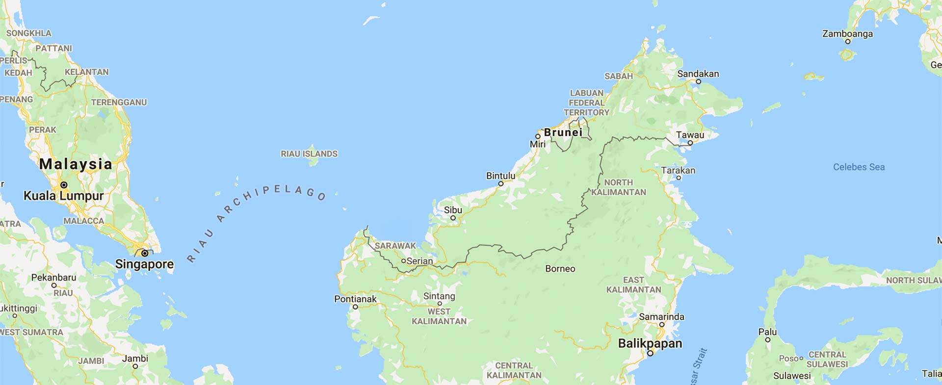
Sarawak is located immediately north of the Equator between latitude 0° 50’ and 5°N and longitude 109° 36' and 115° 40' E. It stretches some 800 kilometres along the northwest coast of Borneo, covering an area of 124,449.51 square kilometres.
The State is separated from Peninsular Malaysia by the South China Sea -- a distance of 600 kilometres. It is directly joined to the State of Sabah to the northeast where the Sultanate of Brunei forms a double enclave. Inland, Sarawak borders with Kalimantan, Indonesia.
Topography
Sarawak is divided into three regions -- coastal lowlands comprising peat swamp as well as narrow deltaic and alluvial plains; a large region of undulating hills ranging to about 300 metres; and the mountain highlands extending to the Kalimantan border.
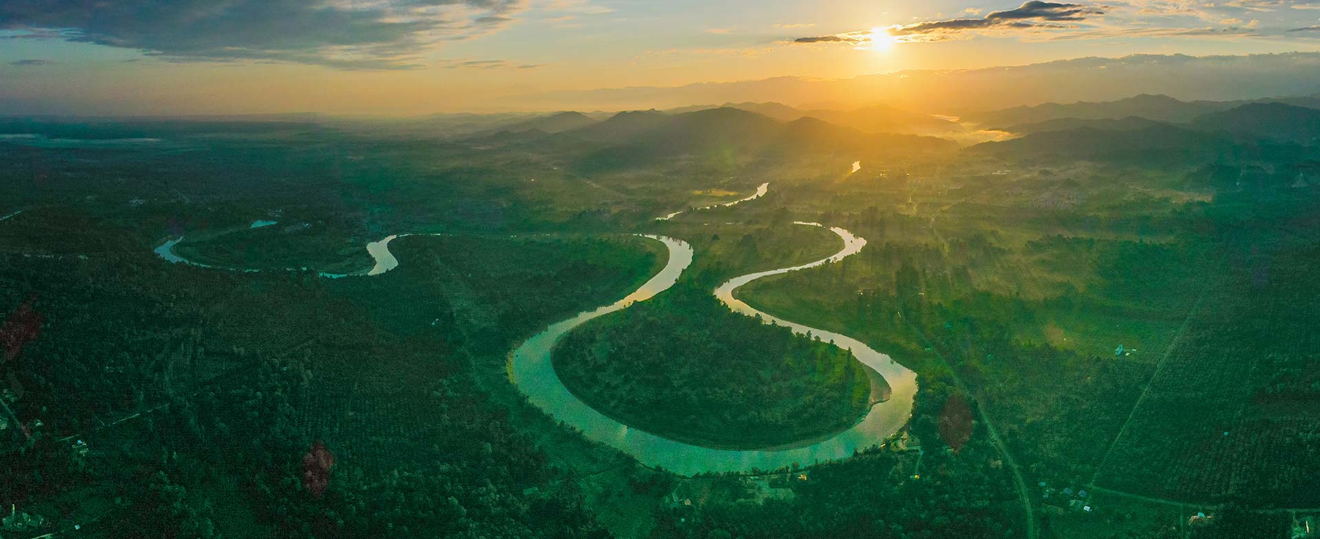
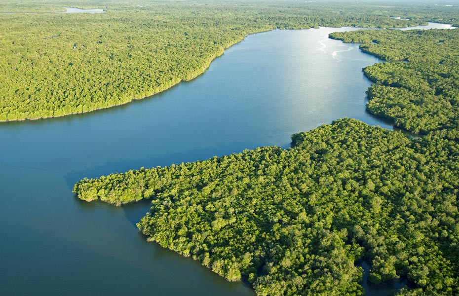
It is home to the Batang Rajang, Malaysia’s longest river, which flows from the Iran Mountain range southwest to Kapit, where it turns westward to complete its 563-kilometre course to the South China Sea. The river is navigable for 130 kilometres to Sibu by ocean-going vessels and for another 160 kilometres to the otherwise inaccessible interior by shallow-draft vessels and small boats like sampans.
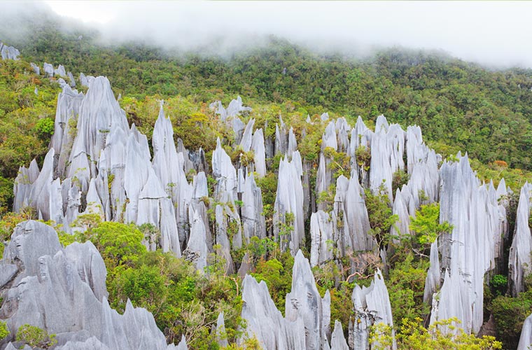
Gunung Mulu National Park
UNESCO World Heritage Site
Sarawak also has a UNESCO World Heritage Site – Gunung Mulu National Park. Important both for its high biodiversity and karst features, Mulu is the most studied tropical karst area in the world. The Sarawak Chamber, 600 metres by 415 metres and 80 metres high, is the world’s largest known cave chamber.
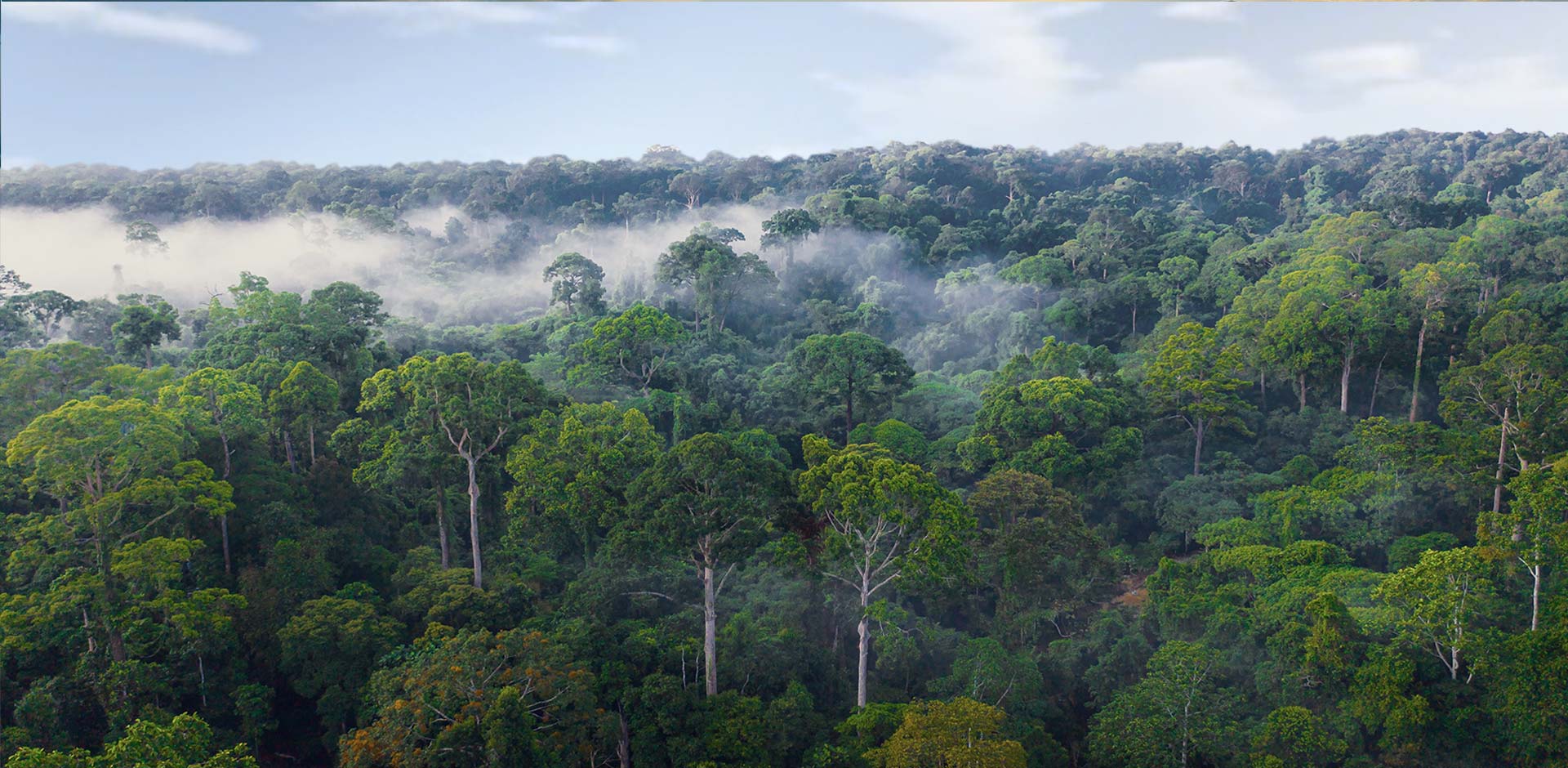
The rainforest of Borneo is acknowledged to be among the world's most distinct and species-rich. About 80 per cent or almost 10 million hectares of Sarawak's total land area is covered with forest (natural as well as secondary forests). The remaining 2.3 million hectares are under settlements, towns, agricultural crop cultivation and native customary rights
Climate and Rainfall
Sarawak has an equatorial climate. The temperature is relatively uniform throughout the year - within the range of 23°C early in the morning to 32°C during the day.
In the highland areas such as Bario, the temperature hovers between 16°C and 25 °C during the day and gets as low as 11°C on some nights.
The northeast monsoon, usually between November and February, brings heavy rain, while the southwest monsoon from June to October is usually milder. The average rainfall per year is between 3,300 millimetres and 4,600 millimetres, depending on locality.
Humidity is consistently high in the lowlands ranging from 80 per cent to 90 per cent.